specialization

Geospatial Imagery Analysis

Explore core concepts, techniques, and professional applications for examining imagery collected via satellite and aerial remote sensing platforms in this two-course specialization. Format: Online

This program is perfect for…

  • GIS technicians, analysts, and specialists
  • Natural resource managers
  • Urban planners and city planners
  • Intelligence and defense analysts
  • Environmental planners and consultants
  • Current undergraduate and graduate students specializing in GIS

What you can learn.

  • Practice methods and techniques for performing geographic image analysis on vegetation, hydrologic features, and anthropogenic landscape features
  • Find out how to use satellite and aerial imagery for performing image classification, change detection, spatial modeling, and terrain analysis
  • Understand fundamental concepts in remote sensing, satellite/aerial imagery, and image analysis
  • Apply machine learning and AI techniques for analyzing satellite and aerial imagery
  • Learn geospatial research methods: formulating, refining, and addressing remote sensing questions through image processing and analysis

See the world through satellite imagery and AI.

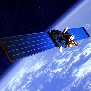
Satelite over earth

The geospatial/remote sensing industries are experiencing rapid growth, due in large part to advances in AI, machine learning, earth sensing, and image analysis. Using technological tools such as the Google Earth Engine platform to access aerial images, it’s now possible to study vital insights applicable to a variety of ecological, environmental, societal, and navigational use cases.

Developed in partnership with UCLA Department of Geography, this two-course program is designed to expand student exposure to remote sensing and image analysis methodologies – including techniques incorporating machine learning and artificial intelligence – for interpreting data about our planet from satellite and aerial imagery.

Designed as a competitive stand-alone program or as a complement to the GIS & Geospatial Technology Certificate, the specialization courses are taught by an academic expert in machine learning and image analysis with extensive experience in the study of environmental change.

Format: Online
Duration: 6 months

Use cases for this technology include, but are not limited to:

  • Agricultural planning: mapping soil type, estimating soil moisture, quantifying crop health
  • Business: surveying real estate, counting cars, mapping nighttime light coverage
  • Climate change: measuring sea level rise, mapping anthropogenic-induced land change, comparing climate factors over time 
  • Disaster assessment: monitoring/predicting wildfires, observing volcanic eruptions, before and after earthquake imagery
  • Oceanography: oil spill detection, algae growth tracking, observing ocean current and temperature anomalies 
  • Transportation: mapping rural roads, locating potholes via aerial photography, providing high-res roadmaps for autonomous vehicles
  • Extraction: locating mineral deposits, monitoring oil reserves, estimating mining progress
  • Society: monitoring urban expansion, tracking displaced refugees, mapping exposed soil for disease prevention

Courses

Click below to view the required and elective courses, if applicable, for this program.

Required Courses

Requirements & Recommendations


This is an open enrollment program. Each class is paid for individually and may be taken without committing to the specialization. However, there are benefits to establishing candidacy.

To get started: 

(1) Register for Introduction to Remote Sensing (GEOG XL 182A), the first courses in the two-course specialization.

(2) Click the Apply Now button below to register and pay for the 'candidacy fee' which establishes you as a student formally seeking to complete the Specialization. Note that this process may be completed at any time after enrolling in a course(s) and does not need to be completed upfront. 

Note: A grade of "C" or better must be earned in both courses in order to fulfill program requirements.

Estimated Cost Breakdown

All courses in this program are paid for individually, unless otherwise noted. An application form is required to establish candidacy in this program. From the 'Apply Now' button, complete the online application and pay the application fee if applicable.

Application & Candidacy Fee

50.00

Estimated Program Tuition

3600.00

Estimated program textbook/materials

N/A

*The Application & Candidacy Fee establishes your candidacy in the program for a period of time covering normal progress toward completion and may allow you to access a variety of program benefits.

**Federal Financial Aid Gainful Employment Disclosures

The U.S. Department of Education requires colleges and universities to disclose certain information for any financial aid eligible program that, “prepares students for gainful employment in a recognized occupation”. This information includes program costs; occupations that the program prepares students to enter; occupational profiles; on time completion rate; and for the most recent award year: the number of students who have completed the program, the number of students who complete the program within the estimated duration, the job placement rate, and the median Title IV and private loan debt incurred by those who complete the program. For gainful employment information for this program, visit our Financial Aid page.

Get Involved

The American Society for Photogrammetry and Remote Sensing (ASPRS) is a scientific association founded to advance knowledge and improve understanding of mapping sciences for the responsible application of photogrammetry, remote sensing, geographic information systems (GIS), and supporting technologies. 

The UCLA Extension Geospatial Imagery Analysis specialization is neither affiliated with nor  endorsed by the ASPRS.

Contact Us

Our team members are here to help. Hours: Mon-Fri, 8am-5pm.
Ready to start
your future?
By signing up, you agree to UCLA Extension’s Privacy Policy.

vector icon of building

Corporate Education

Learn how we can help your organization meet its professional development goals and corporate training needs.

Learn More

vector icon of building

Donate to UCLA Extension

Support our many efforts to reach communities in need.

Innovation Programs

Student Scholarships

Lifelong Learning

See More